A place to begin
The Vredeburg Historical Atlas explores Yogyakarta through the places where its history took shape. Palaces, schools, markets, mosques, government buildings and public squares become starting points for understanding how people lived, organised, governed and fought. The project brings these places into a shared geographical and chronological setting, allowing a visitor to move between the story of one building and the wider history around it.
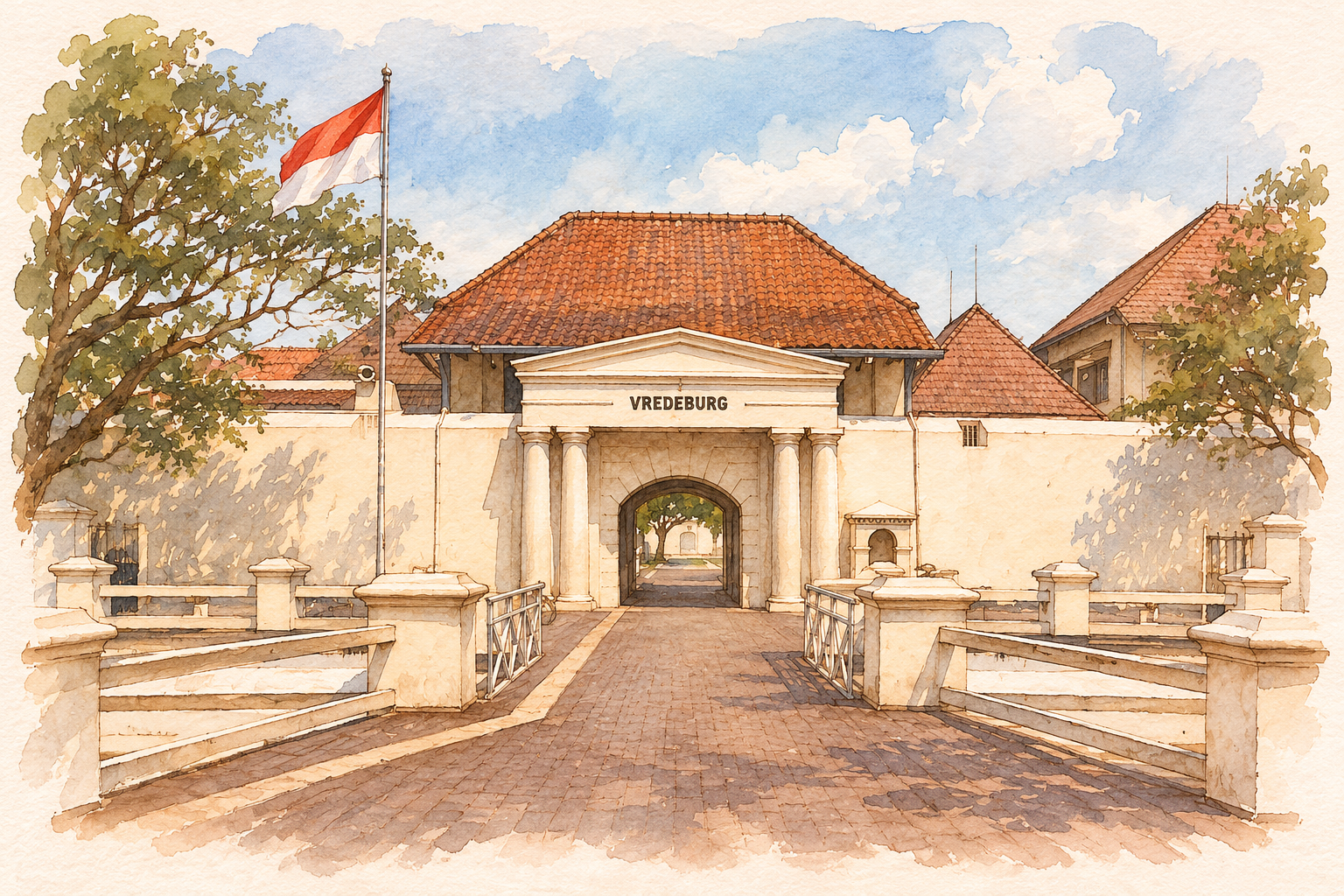
Fort Vredeburg provides the project’s point of departure. Its position near the royal palace brings colonial power and court authority into the same urban landscape. Its later life as a museum adds another layer: the presentation of the struggle for independence to subsequent generations. From this meeting of architecture, politics and public memory, the atlas opens out across Yogyakarta, Central Java and Indonesia.
The longer history
The story begins with Islamic Mataram at Kotagede. Following the early rulers and the movement of the court to Kerta and Plered helps explain the political world from which Yogyakarta emerged. Sultan Agung’s expansion, the campaigns against VOC Batavia, internal conflict and the division of Mataram establish the background to the new sultanate and its capital.
The chronology then follows changes in royal authority, colonial intervention, education and organised nationalism. A school can connect the city to Budi Utomo; a neighbourhood can lead into the history of Muhammadiyah; a meeting house can reveal the work of the women who gathered for the first Indonesian Women’s Congress. These connections give everyday urban places a broader historical significance.
The Revolution brings another geography into view: government offices, military targets, airfields, diplomatic accommodation and clandestine communications. Yogyakarta appears as a royal city and a centre of Republican government. International developments belong within this story too. European wars, changing colonial administrations and negotiated settlements provide essential context for understanding shifts of power in Java.
People give these larger changes their local meaning. Rulers negotiated and resisted, teachers built institutions, women organised across associations, and communities sustained political movements. Keeping these activities in view connects the decisions of courts and governments with the social relationships through which history unfolded.
Four ways of looking
The atlas works at four scales. Central Yogyakarta brings the palace, fort, markets and nearby institutions into close relationship. Greater Yogyakarta connects the city with earlier court centres, resistance sites and places of diplomacy. Central Java places neighbouring cities and courts within the same regional landscape. The Indonesia view follows connections across the archipelago.
Each scale answers a different question. Close views help explain how institutions shared an urban setting. Wider views reveal journeys, networks and the distance between related events. Labels and markers change with the scale so that the main relationships stay readable. Opening a location brings together its significance, associated events, illustration and sources.
The background map shows modern geography. Historical information is added through the atlas’s records. Landmark pins identify buildings or complexes, while area markers represent cities, squares, islands and other broader localities. This distinction helps readers understand the geographical scale of each story. Search and era filters offer further ways to explore a particular movement, period or place.
A useful route begins with one building. Read its story, look at the events attached to it, and then widen the map. Nearby institutions can reveal a shared setting; distant places can reveal the reach of a journey, an organisation or a political network.
Following the sources
The museum guidebook forms the project’s documentary foundation. Its historical accounts, exhibition descriptions and place names connect the collections to a wider landscape. The atlas brings this material together with official heritage records, court histories, geographical references and archival collections. A source link allows readers to follow an account back to the document or institution behind it.
Historical dates retain the detail supplied by their sources. A year appears as a year; a recorded day appears as a day. Location records likewise distinguish individual landmarks from larger areas. When sources give different dates, the difference is stated directly alongside the account. Readers can examine those details while continuing to follow the historical sequence.
The museum itself is also part of the history being explored. Exhibitions select events, emphasise particular people and express the outlook of the period in which they were created. Reading their accounts alongside other sources helps explain how the past has been remembered. The atlas gives visitors a route into both the events and their later public presentation.
A painted atlas
Watercolour illustrations give the atlas a consistent visual character. Building studies draw attention to roofs, entrances, courtyards and the architectural features that make a place recognisable. Archival portraits bring people into the narrative. Where an event photograph provides a useful reference, its composition can connect readers with the participants and setting recorded by the camera.
The artwork is created with AI in a handmade pen-and-watercolour style, using selected photographs and historical images as references. Captions identify the subject and reference date, and credits link back to the source. Present-day architectural studies and dated archival views are labelled accordingly. Period suitability guides image selection, including the exclusion of modern vehicles and later city skylines from historical scenes.
Part of the Connectome project
The atlas is built by Reza Rosli as an application of his Connectome project. His connected-notes approach gives each focused record its own context, sources and explained links. Here, a place, person, event or source becomes a record that can be read independently and followed into a larger historical network.
This also applies the ideas in AI-augmented knowledge environments: capture knowledge, give it useful structure, inspect its origins and revisit its interpretation. AI assists the work of organising material and creating illustrations. Authored records, explicit relationships and source references give readers a way to examine the result and develop their own understanding.
The Connectome view presents the same historical material as a graph. Choose a place to see its events, follow an event to the people and sources involved, or select a relationship to read why the records are connected. Maps reveal geography, the timeline reveals sequence, and the graph reveals relationships across the collection.